| Parish/District | Tydd St Mary/South Holland |
| Location | on a roadside verge 80m north of Poultry Farm |
| Category | Boundary cross |
| National Grid Ref | TF 41873 18579 |
| Designation | Scheduled |
| Stone Type | Limestone |
| Refs | AP Survey 28 June 1995; Davies, D S, 1915, Lincs N & Q, Vol XIII No.6, p.222 |
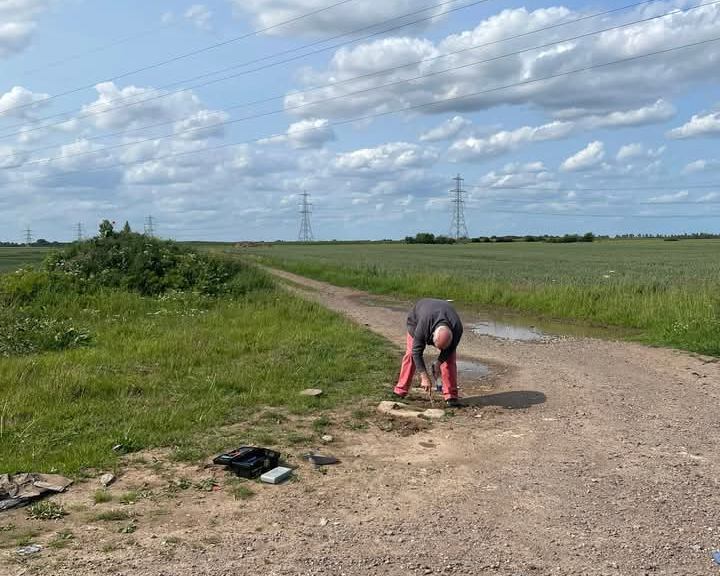
| Visits | AP: 28 June 1995 | DS/HH: Not Visited | DS 4 June 2025 |
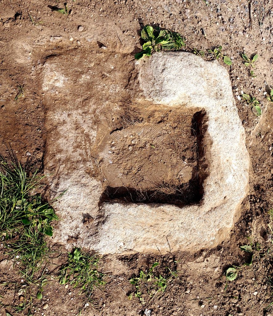
There is the buried socket stone of a boundary cross (known as the White Cross or Sutton Cross) on a roadside verge (which is the parish boundary) 80m north of Poultry Farm on Draw Dike between Sutton St James and Tydd St Mary.
In 1995, AP reported that this socket stone was almost entirely buried with only c. 50mm of its upper surface visible. An NMR record (1965) notes ‘The base is now covered by a pile of road gravel’. When I visited in 2025 the stone was almost invisible and level with the track surface. Davies was luckier in 1915 – He records that the socket stone is 12½” (0.32m) high and ‘On one side of the base there is a raised design nearly half moon in shape’.
The socket stone is much damaged and the groove/slot in the upper surface recorded by AP is now broken away and eroded and not visible. The visible top face of the stone is c. 0.63 x 0.60m with a square socket c. 0.3 x 0.3m. The socket was filled with soil and rubble and was not emptied.. No decoration or chamfer was visible (but note Davies’s comment above)