
| Parish/District | Crowland/South Holland |
| Location | Remounted on a modern rough stone plinth at the south side of Wash Bank, c. 20m west of the crossroads with the old A1073 (now Spalding Road) at Brotherhouse Bar |
| Category | Boundary Cross (Wayside Cross) |
| National Grid Ref | TF 26033 14940 |
| Designation | Scheduled / Listed II |
| Stone type | Barnack Stone – Pale yellowish grey shelly oolitic limestone, |
| Refs | Included in Everson and Stocker here; Fenland Past & Present, 1878, Ch. III, pp. 73-76; Canham, A S, 1887 Fenland Notes and Queries vol II; Healey, Hilary, 1993, ‘Rolling Stones’ in Lincs Past & Present No 10/11 Spring 1993 p.22 |
| Visits | DS/HH: 17 January 2006 |
Guthlac’s stone has been researched and illustrated by many historians – it is illustrated in Camden’s Britannia (1695) and in Stukeley’s Itinerarium Curiosum (1724). There is much speculation as to the origin and meaning of the inscription, which appears to have been recut (possibly by the Spalding Gentlemen’s Society) in the 18th century. Camden recorded the inscription as:
AIO/HANC/PETRAM/GVTHLACVS/HABET SI-/BI METAM
which, loosely translated, is ‘This stone, I say is Guthlac’s utmost bound’. (Later renderings have it as: ‘Guthlac has this stone as a boundary for himself’)
Although the stone has been moved on several occasions, it is thought to be close to its original location. It spent some years as a garden ornament at the Boat Inn (TF 26031493), until that pub’s demolition in 1961, when it was moved to its present dismal position as a roadside feature. This brought its own dangers as illustrated by Hilary’s B&W photograph below (I don’t know the date of this). The road (the ex A1073) has since been downgraded to a lane by the construction of the Crowland bypass, so Guthlac’s cross should be safer in future.
There is a full description and discussion of the cross in in Everson and Stocker, and this is not repeated here.
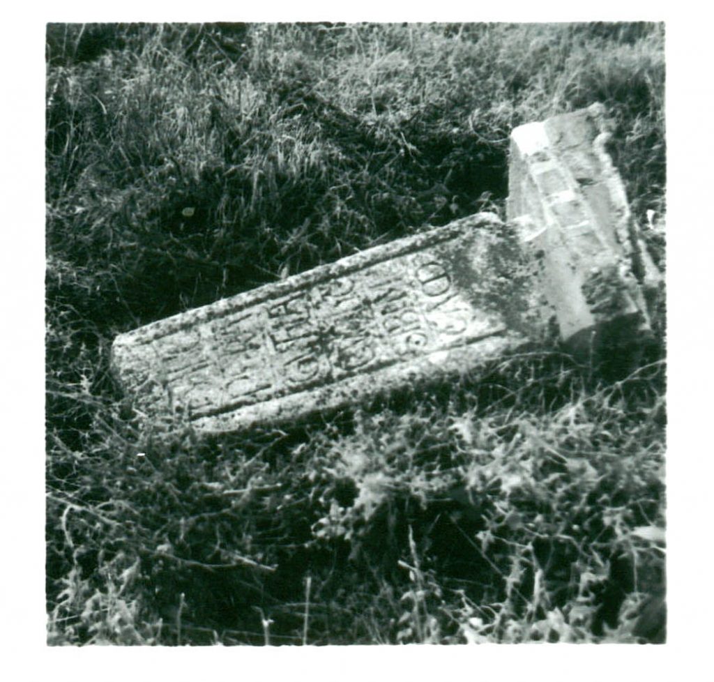
(date unknown)

