| Parish/District | Horbling/Donington – South Kesteven/South Holland |
| Location | depicted on 14th C Map of the Fen – but exact location unknown |
| Category | Lost Boundary Cross |
| National Grid Ref | Unknown but thouight near to: TF 17338 35605 |
| Designation | Lost Cross |
| Stone Type | Lost Cross |
| Refs | TNA. MPCC, 1/7 (Map); |
| Visits | – |
The Bridge End Causeway (historically known as the Holland Causeway) is a medieval route that originally ran for over three miles across the fens between Horbling and Donington. The route is still in use today and forms part of the modern A52 road.
A Gilbertine priory was founded at Bridge End and was charged with the task of maintaining the causeway. To help with its income, Bridge End was granted a market and two annual fairs in the mid 14th century.
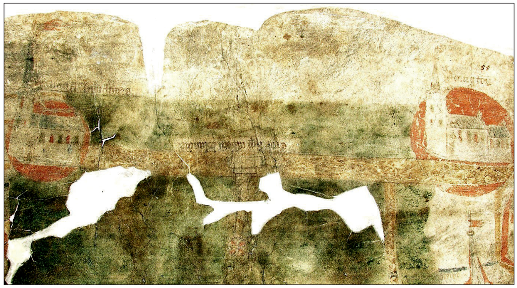
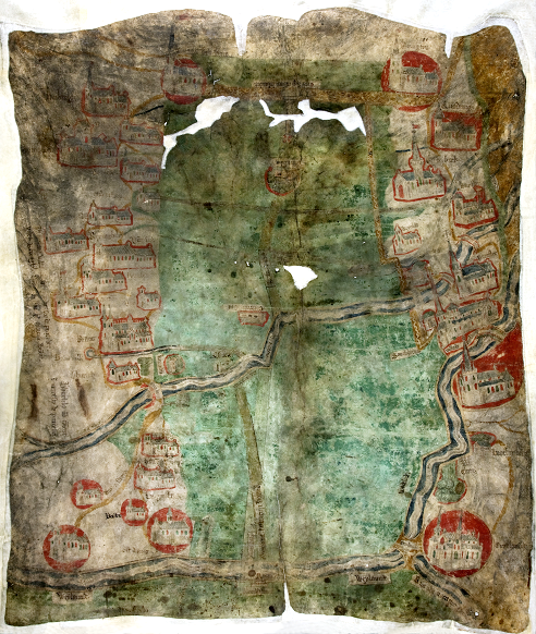
There was a chapel on the causeway and a boundary cross was also located on it. The cross is depicted on a 14th century map of Pinchbeck Fen and is named as the Cross of St Mary.
The 14th century map (Ref TNA/ MPC 100; DL 31/55) also shows the churches, abbeys, rivers and roads in the area between Donington and Crowland. Some of the earliest depictions known.
The Bridge End Causeway is still thus named on modern O.S. Maps. No cross survives, but there is still a building named Priory Farm at Bridge End which has stonework – potentially from the original Priory buildings.
I am grateful to Dr Brian Hodgkinson for drawing my attention to this lost Lincolnshire cross. Brian has published a paper on The Holland Causeway and Bridge End Priory, in Lincs Hist. & Arch., Vol 50, pp. 79-93.